About four thousand years ago, long before the Roman legions thundered through the Iberian Peninsula or the stone castles of medieval Spain pierced the skies, a powerful society emerged in the sun-baked lands of what is now southeastern Spain. This society, known as El Argar, is considered one of the earliest state-level civilizations in Western Europe. But how did it define itself? How did it shape its influence, and more importantly, how did it manage its relationships with neighboring communities who did not share its centralized political structure?
A new and groundbreaking study from researchers at the Autonomous University of Barcelona (UAB) and the Max Planck Institute for Social Anthropology is shedding light on exactly those questions. Drawing on an innovative blend of archaeological techniques and cutting-edge geographic modeling, the team has uncovered the invisible lines—economic and political borders—that once divided El Argar from its less centralized neighbors in the regions of La Mancha and Valencia during the Bronze Age (circa 2200–1550 BCE). The findings, published in the Journal of Archaeological Method and Theory, are transforming how scholars understand not just El Argar, but also the very mechanisms through which prehistoric states consolidated power and influence.
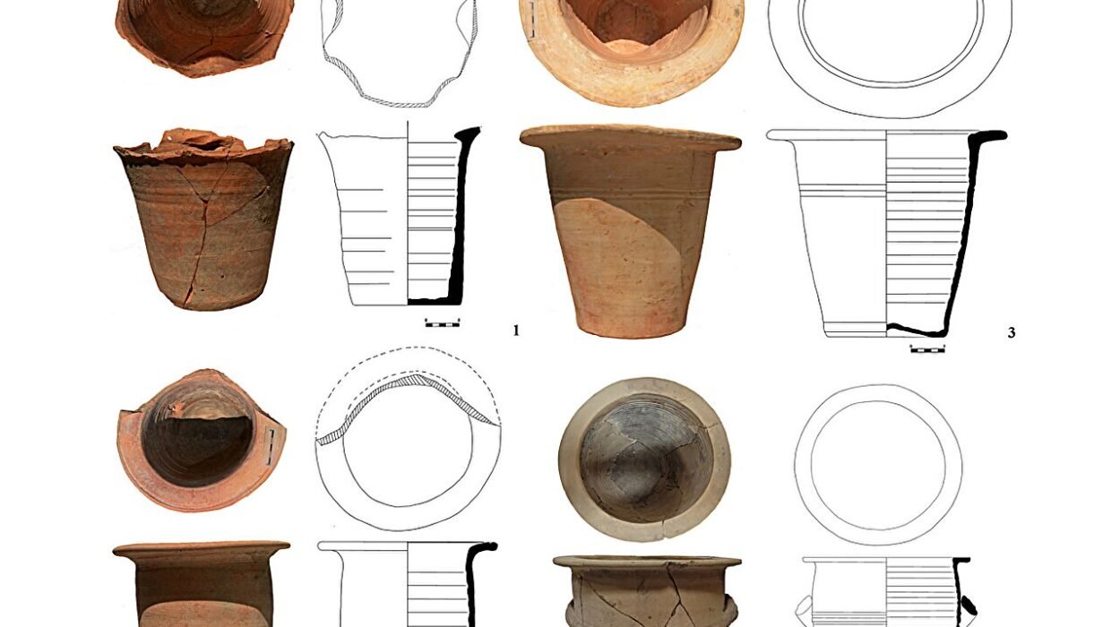
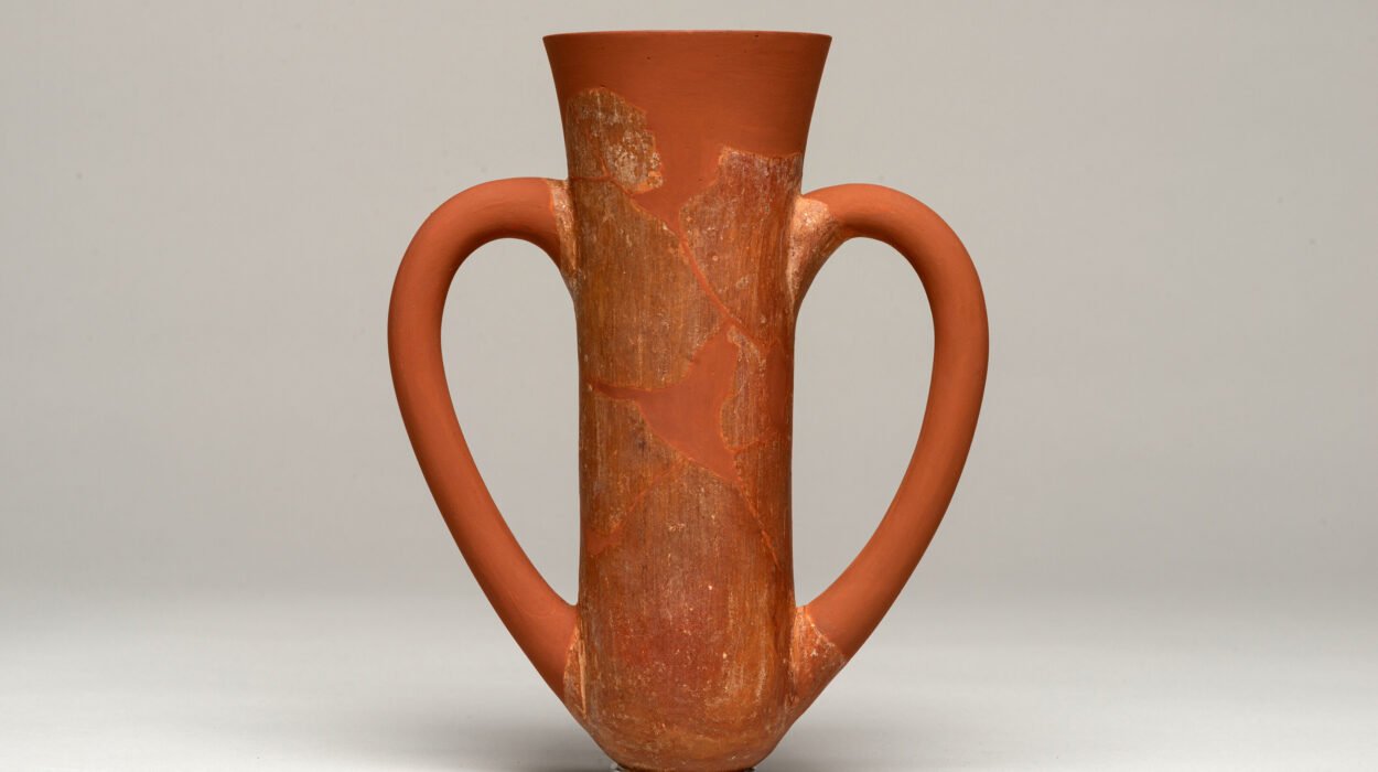
At the heart of the study is something deceptively simple: pottery. Not golden artifacts, not grand temples, but humble ceramic vessels. These containers, ubiquitous in daily life, hold within them a surprisingly detailed map of ancient economic systems, cultural boundaries, and political authority. The researchers zeroed in on a strategic area: the northern part of present-day Murcia, a true borderland where the Argaric heartland met other Bronze Age groups. Here, they examined the production and circulation of pottery with a level of precision previously unseen in Iberian archaeology.
Their approach was both meticulous and multi-pronged. The team conducted wide-ranging field surveys, carefully cataloging ceramics across numerous settlement sites. They then performed petrographic analysis, a microscopic examination of the mineral composition of pottery, allowing them to trace where the clay came from. To that, they added geographic information systems (GIS) modeling, which let them spatially map the flow of pottery across the region.
What they discovered was nothing short of revelatory. The ceramic landscape was sharply divided. In the southern half of the Segura River basin, pottery showed consistent characteristics of Argaric craftsmanship, made with clay sourced from specific deposits over 100 kilometers to the south, in the mountainous coastal areas of Murcia and Almería. These ceramics were not local. They had been manufactured in the heart of Argaric territory and transported—across rugged terrain and considerable distances—into the borderlands. This suggests a regionally organized distribution system, controlled by the core El Argar settlements. It also implies something more profound: the presence of a centralized political and economic infrastructure capable of managing long-distance trade and asserting influence deep into neighboring territory.
In contrast, the northern half of the study area told a different story. There, pottery was made locally, using clay found nearby. The diversity of styles and materials reflected small-scale, domestic production—the work of households or local craftspeople rather than centralized workshops. There was no large-scale distribution network, no evidence of standardized production, and no signs of external control.
This stark divide paints a picture of two very different worlds, coexisting side by side. On one hand, El Argar, with its unified political authority, extensive resource networks, and control over both strategic goods like metals and mundane items like ceramics. On the other, more loosely organized communities, where production remained local, and authority was likely decentralized. The researchers argue that this contrast is not merely economic—it reflects a core-periphery relationship, with El Argar asserting dominance through the selective control of resources and trade.
“The border wasn’t just a line on a map,” explains Adrià Moreno Gil, the lead author of the study and a researcher at the Max Planck Institute. “It was a dynamic zone of interaction, negotiation, and asymmetry. It’s where power relations were played out—sometimes subtly, sometimes forcefully—through the movement of everyday objects like pots.”
The implications of this study go far beyond southeastern Spain. It challenges archaeologists to rethink how they identify state structures in prehistory—not just by monumental architecture or elite burials, but by analyzing the everyday economic and social systems that support state power. The research also underscores the importance of studying borders, which have often been neglected in archaeological scholarship, even though they are key to understanding how ancient polities maintained authority.
“The concept of ‘archaeological cultures’ already implies spatial limits,” notes Roberto Risch, UAB professor and coordinator of the study. “But rarely do we ask how those limits actually functioned. This study is one of the first to look at prehistoric borders not as static edges, but as active, negotiated spaces.”
Indeed, the researchers describe these frontier zones as contact zones—regions of both exchange and inequality. The circulation of Argaric pottery into non-Argaric areas wasn’t necessarily peaceful or cooperative. It may have been part of a strategy to assert economic dominance and subtly transform neighboring communities into dependents. Through control of material goods, El Argar could shape behavior and allegiance without needing to conquer militarily. In essence, pots became instruments of power.
Perhaps most significantly, the study reinforces the idea that El Argar represented a true state-level society. With a core territory of just 5,000 square kilometers, it eventually came to control an area seven times larger—35,000 square kilometers—through economic integration, resource monopolization, and political centralization. The ability to extract resources from peripheries, redistribute them, and maintain control over distant production and exchange networks is a hallmark of early state formation. And now, thanks to this new research, we have concrete evidence of how those processes played out on the ground.
The methodology used by the team may also serve as a template for future studies across Europe. Societies like the Únětice culture in Central Europe or the Minoan civilization in Crete also exhibited complex economies and regional influence. Yet the mechanisms of their territorial expansion and boundary maintenance remain murky. Applying similar ceramic-based, GIS-enhanced techniques could unlock new understandings of how early states across the continent shaped their worlds.
“Ceramics are one of the most ubiquitous archaeological materials we have,” says Carla Garrido García, co-author and predoctoral researcher at UAB. “And yet, they are too often overlooked when it comes to the big questions about social organization, political power, and state formation. This study shows how powerful they can be.”
In many ways, the story of El Argar’s borders is a story of tension—between the local and the centralized, the domestic and the state-controlled, the peripheral and the core. It’s a story told not in swords or fortresses, but in the humble arc of a clay vessel. It reminds us that even in prehistory, boundaries were not just physical, but ideological. They marked not just where one community ended and another began, but who held the power to shape the flow of goods, people, and ideas.
As archaeology increasingly turns its focus to systems and structures, rather than merely spectacular finds, studies like this one are invaluable. They offer a more nuanced, more human picture of ancient societies. El Argar, it turns out, wasn’t just a kingdom of warriors or metallurgists—it was a sophisticated, tightly organized society that knew how to use both metal and mud to define its world. And in doing so, it may have laid the groundwork for the complex state systems that would later define Europe’s Bronze and Iron Ages.
More information: Adrià Moreno Gil et al, Bronze Age Frontiers and Pottery Circulation: Political and Economic Relations at the Northern Fringes of El Argar, Southeast Iberia, ca. 2200–1550 BCE, Journal of Archaeological Method and Theory (2025). DOI: 10.1007/s10816-025-09702-y